
What does Easter mean to you? Chocolate eggs? Mysterious rabbit behavior? The death and resurrection of Jesus Christ? To me, Easter means only one thing – a four day-long, annual leave-free, unadulterated wilderness adventure!
At least it usually does. How we ended up spending most of this year’s long weekend cowering under a saturated tarp, having driven nine hours for the privilege, is a matter of some conjecture. And yet the overwhelming reason for our catastrophic failure was not ours alone, but yours too, and theirs, and virtually everybodies in the world.


HOW IT ALL STARTED
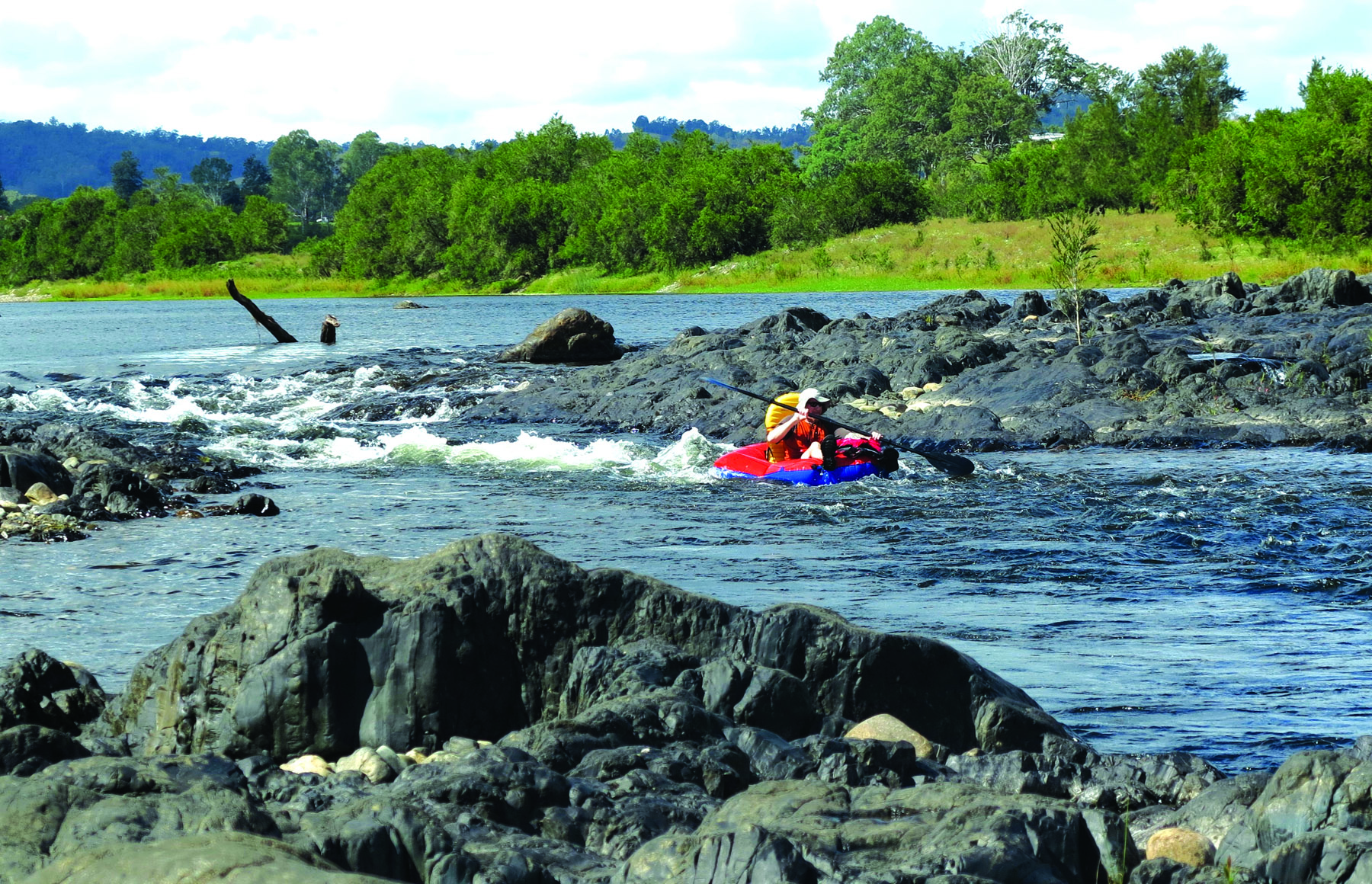
Some six months previously Paul, Gerda and I had discussed what manner of adventure the Easter period would entail, and settled on kayaking. With Paul living in Brisbane and my wife and I in Sydney, we searched for equidistant locations and hit upon the Clarence Canoe and Kayak Trail in northern NSW. The intoxicating combination of the Nymboida, Mann and Clarence Rivers, along with 195km of hairy rapids, unspoiled campsites and flat water drifts, makes this the longest commercial white-water paddle in the country.
Conceived in 2017, the CC&KT is a masterpiece of promotion, a hiking trail for water babies with a series of excellent maps showing distances, times, compulsory portages and river gauges. The project was spearheaded by Clarence Valley Council and funded by the federal government to the tune of $250,000, a sum used to develop the campsites and colourful brochures which make planning a trip here an absolute breeze. With the only unknown factor being the April weather, our trio was ready for action months before setting blade to water. So when we rock up at Copmanhurst boat ramp in the small hours of Good Friday morning, we’re excited to sleep, rest, wake, and be on our way.
PREMONITIONS
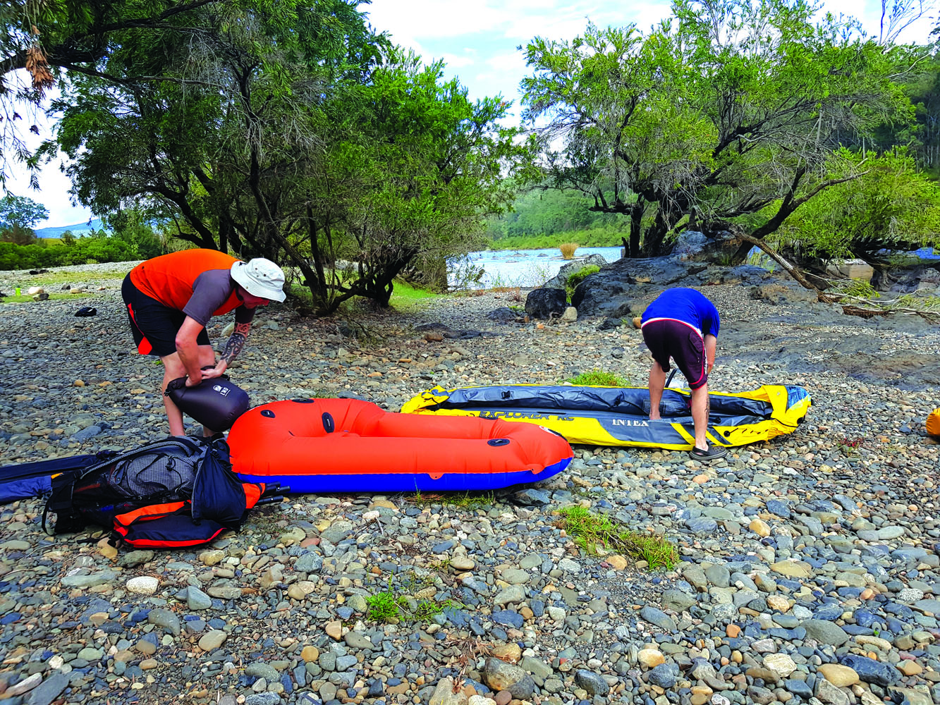
Although the trail officially begins in Nymboida-Bindaray NP and runs through to Copmanhurst, our timeframe only allows for the second half of the eight-day trail. Fortunately, due to the confluence of the Mann with the Clarence and the waterway’s subsequent about-turn, our put-in point at Jackadgery is only an hour’s drive west of Copmanhurst, a mere trifle of a car shuffle which has us inflating our craft by 10:30am. And this is when things start to look a little iffy.
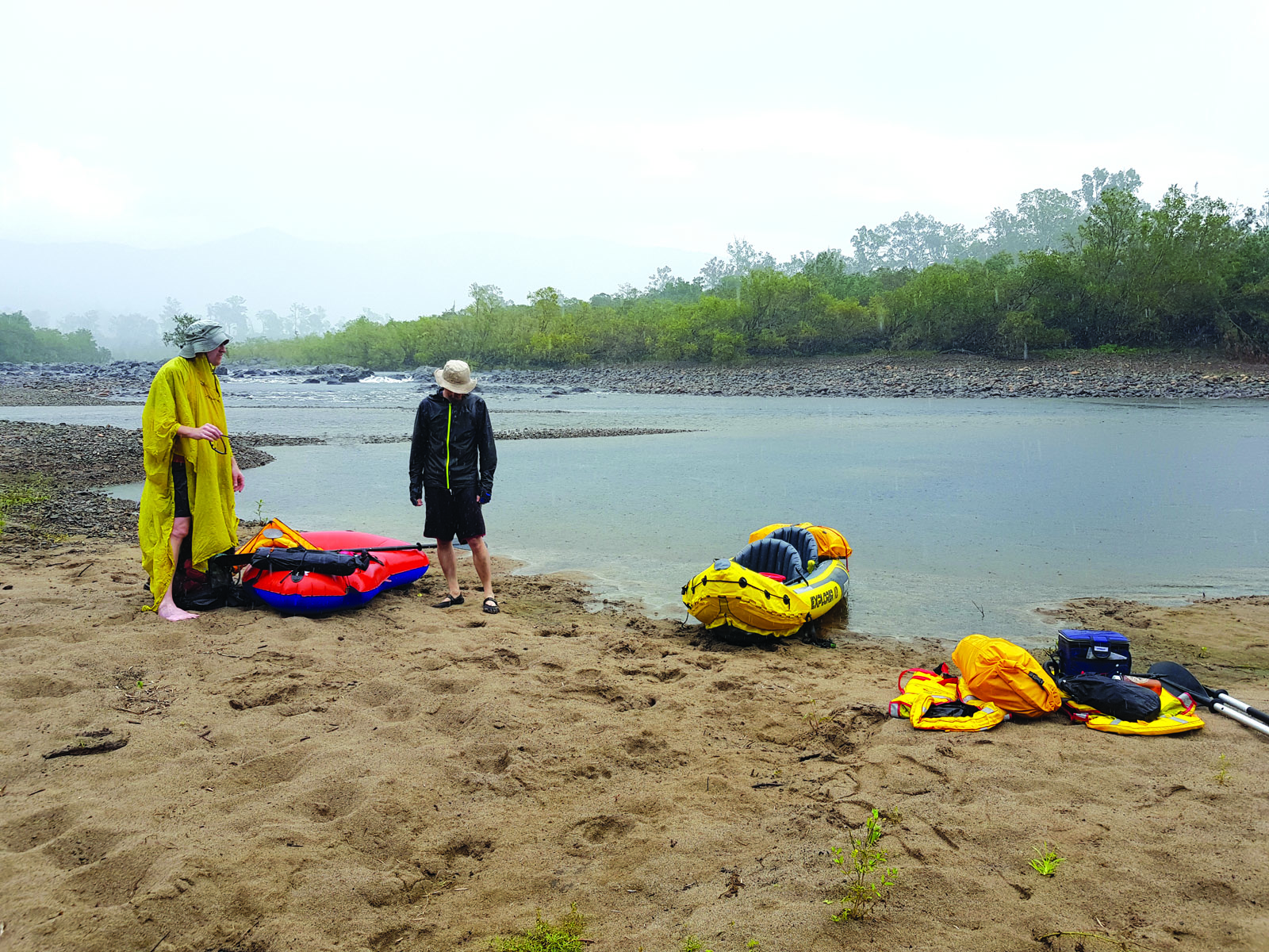
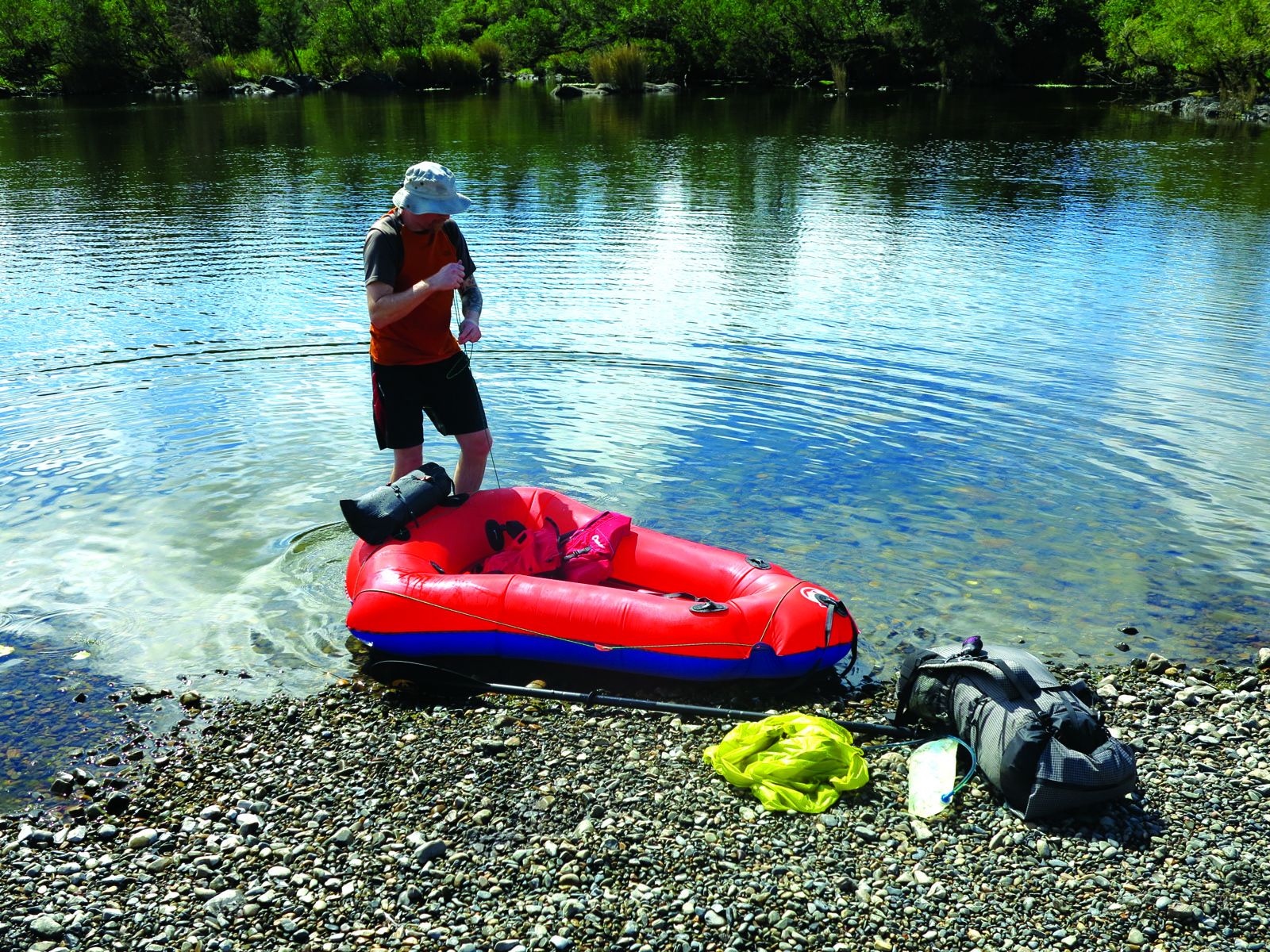
Paul, swept up in the excitement of the emerging phenomenon, has eagerly bought himself a pack raft with grand ideas of combination hiking/cycling/padding trips, and this is to be its maiden voyage. Such is his zeal for his new craft that Gerda and I feel vaguely self-conscious of our cheap, tandem inflatable, even though it has given us years of trouble-free kayaking. We watch, ready to be impressed, as he unfolds his pristine craft and fills it with air, only for our enthusiasm to deflate like a punctured beach ball. He’s clearly purchased a pool toy by mistake. It resembles a giant marshmallow arrow-head, and looks to be about as useful. “Pffft!” splutters Gerda, never great at hiding her emotions. “Is that it?”
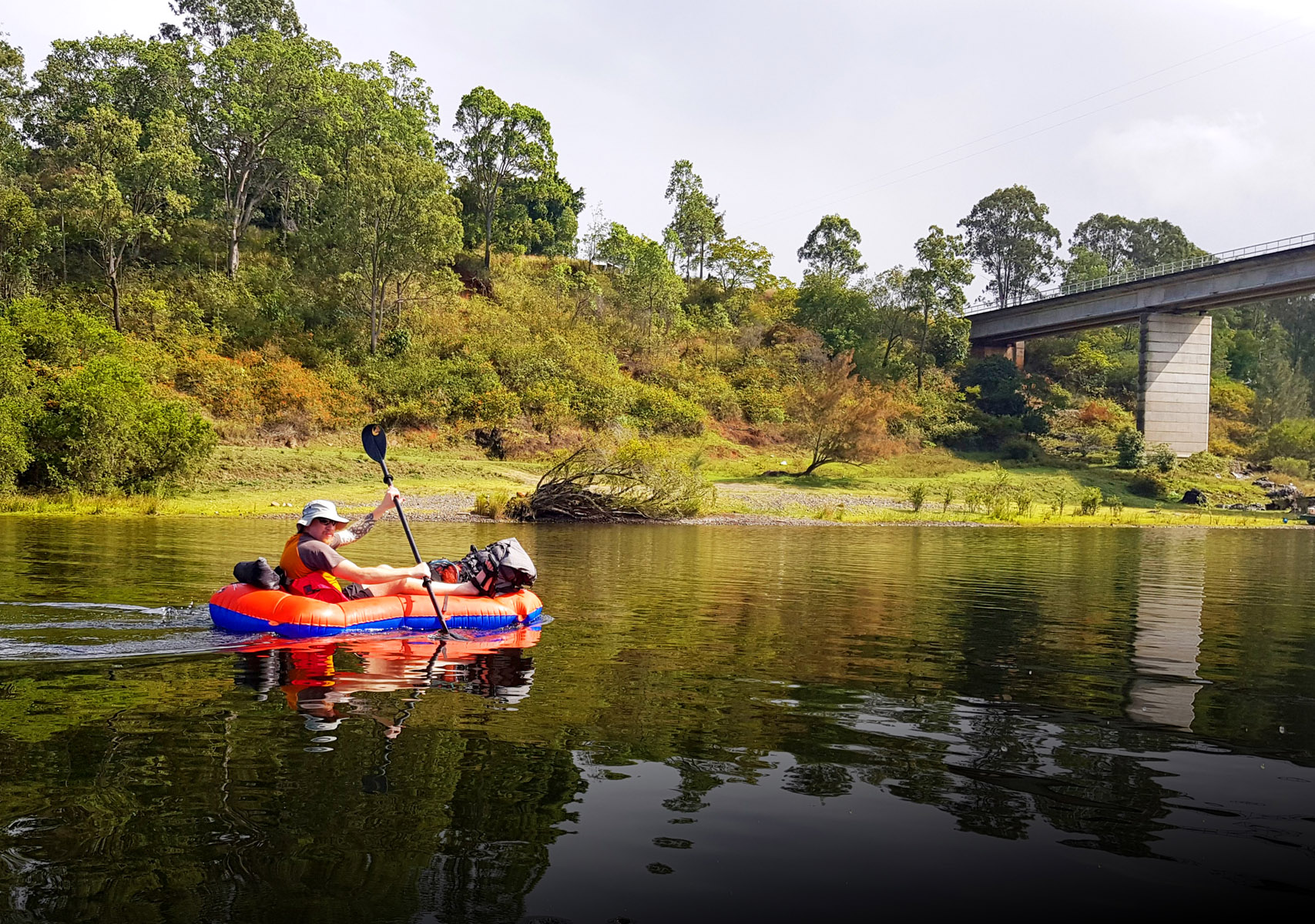
Paul, unperturbed, clambers aboard and we get underway along a picturesque stretch of water, its meandering banks lined with sculpted granite boulders and flanked by pretty farmland. The rock shines after the morning showers, curves glinting in any sun that sneaks through the concrete sky, and where it strays into the river’s centre we discern jumbles of stone beneath the still water, stacked like the crouching bodies of long-petrified giants.
Tide marks betray that the river level is low, a fact of which we are well aware. The CC&KT brochure indicates minimum and maximum runnable water levels and which river gauges to check them against on the Bureau of Meteorology website. This week’s readings are about 10cm below the minimum and a good 50cm below optimum levels, but as a group we have decided to go ahead. The forecast is for intermittent rain, a 60 per cent chance of 5-10mm according to the BOM. Maybe that will help?
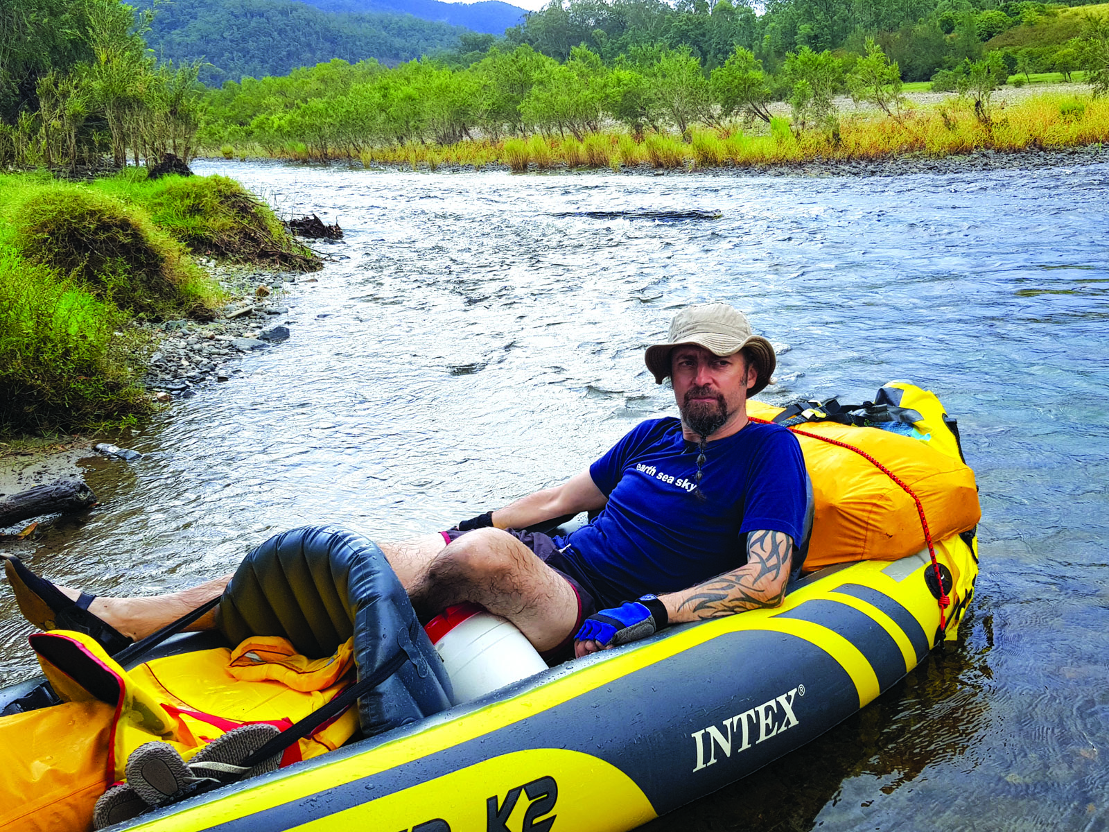
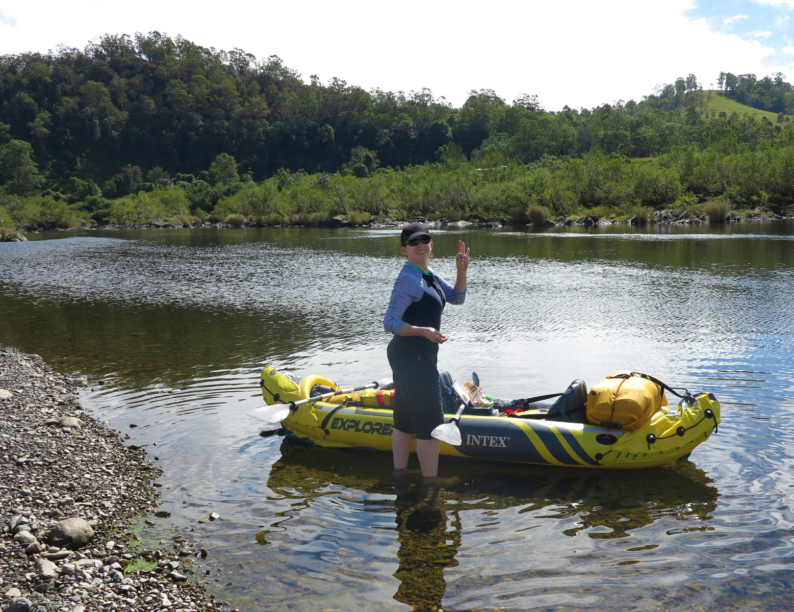
It soon becomes apparent that Paul’s overpriced Li-Lo is a nightmare to control. Unlike ours, it has no keel or skeg to retard its natural inclination to swing with the wind or any but the most careful paddle stroke, and he is constantly fighting to keep it in a straight line. It is also deficient in the seating department, and shortly after starting he has to insert his sleeping mat chair kit for back support. He still sits very low in the water, his legs angled up and out like an unguarded Barbie doll salaciously posed by a vindictive older brother. Ten minutes later the adhesive lash points he has affixed peel completely off and we have no option but to stop again and strap his bags alongside our own.
KAYAKING, THIS IS NOT
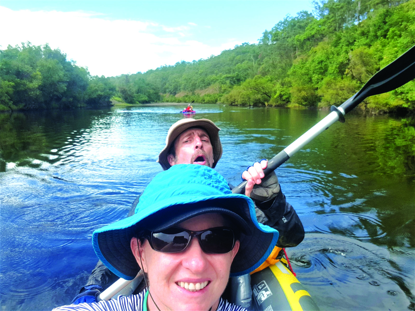
The first couple of rapids are piffling Grade 1s that make us hungry for more. The full trail features seven grade 3 rapids, three grade 4s and three compulsory portages, and although we are by no means beginners, we aren’t experienced white-water paddlers either. We are here for the deep, relaxing sections in between and will be hauling our gear around anything more violent than a flushing toilet.
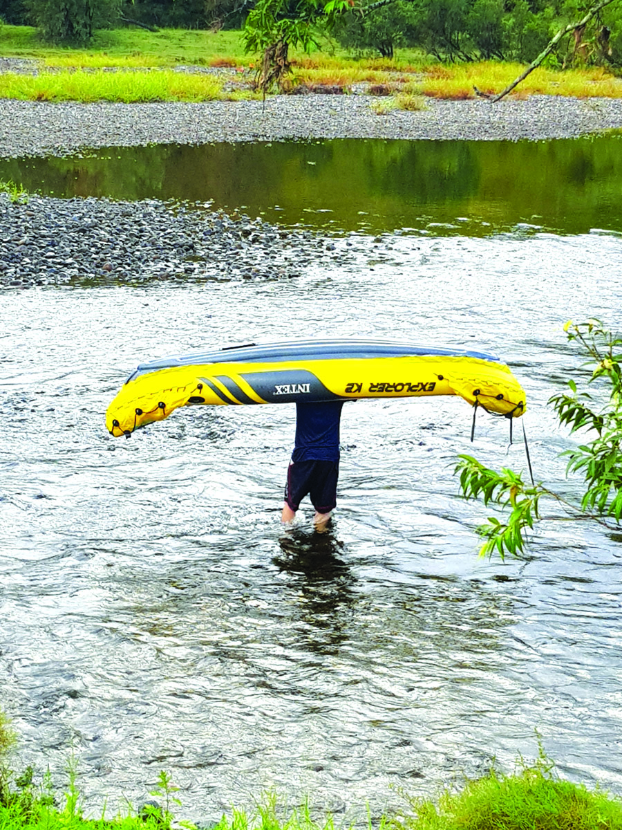
Unfortunately, this is not likely to be a problem. Little by little the rapids get progressively shallower and soon we find ourselves scraping bottom more often than not, bumping bums on boulders and pushing along with paddles. Ironically, Paul’s baggage-free, flat-bottomed girl coasts through them like a hot iron gliding over a bed of silk and he has to kill time while we walk, pulling our fully-laden boat behind us. The rocks underfoot are slippery and uneven and every misplaced step jams my poor paws between hard pebbles, exponentially increasing my frustration. Kayaking, this is not. I’m wearing some old Vibram Five Fingers, those creepy zero-drop runners with individual toe sockets, and they show their objection to the unexpected work by casting free their rubber soles and leaving me floundering about with little more foot protection than a layer of spray-on latex.
To add to our discomfort, whenever we actually get afloat the kayak fills with water. Despite epic bailing sessions we remain arse-deep in the Mann River, our tethered water bottles floating around our knees. Have we forgotten to close the drainage port? No, so what the hell is going on? Further investigation reveals a fist-sized hole in the bow of the boat, and another in the stern. The welded seals have split, flooding us like Boiler Room 6 of the Titanic after clipping its icy nemesis. This is yet another small inconvenience but still not a deal breaker. We are, after all, prepared for getting wet.
THE CORONER’S REPORT
The water becomes shallower and shallower as we half-hike, half-paddle the approach to Cangai Falls, too busy to appreciate the natural beauty of our surroundings. By 3pm we have hit roughly a third of the day’s target and are feeling a tad dispirited. Why is the water so unseasonably low? Is it the current NSW drought or is the sinister shadow of climate change creeping up to ruin the adventures of good, honest outdoorsfolk? I later seek out Danny Parkin of Clarence Valley Council, chief photographer for the brochure and white-water kayaker of 25 years experience, to try to find an answer.
“Generally the rains are summer-based, and back in the good old days you would have been guaranteed enough water over Easter,” he tells me, unconsciously assuaging my guilt at having arranged our visit at a stupid time of the year. “We used to come down from Brisbane every Easter to paddle everything and anything,” he continues, “but if you look at rainfall over the last 100 years it goes in cycles. In the 90s we had five years of below average rainfall, then 2010-2014 was the opposite; the Nymboida flooded every Australia Day. Now the last few years have been drier again. We didn’t get the rains this Christmas so we are in one of those dry cycles. Things are definitely changing though, climate wise,” he adds.
Danny’s anecdotal evidence proves inconclusive so I turn to more scientific analysis, consulting the Department of Primary Industries Combined Drought Indicator. The northern section of the kayak trail is classified as being in intense drought, along with 15.2 per cent of NSW, and the southern half in regular drought (30.6 per cent of NSW). However, just being in a state of drought is not an indicator of climate change. The country suffers droughts approximately every 18 years, with particularly fierce ones in 1902-1903 (the Federation Drought) and 2001-2009 (the Millennium Drought). The current NSW dry spell began in mid-2017 and is already considered severe.
Drought is a complicated combination of many factors, not just a lack of rainfall. Humidity plays a part, as well as air temperatures and wind speeds. With reference to various weather indices and scientific articles, a post on theconversation.com last year (titled Is Australia’s current drought caused by climate change? It’s complicated) postulated that “there is some evidence to suggest that climate change is exacerbating drought conditions in parts of Australia, especially in the south-west and south-east.” It also warned that “increased greenhouse gas emissions mean an increased probability that low-precipitation years are also warm, suggesting that under climate change droughts may be hotter in some parts of the world.” It’s carefully worded but the implication is clear – things are going to get worse.
NOT OUT OF THE WOODS YET
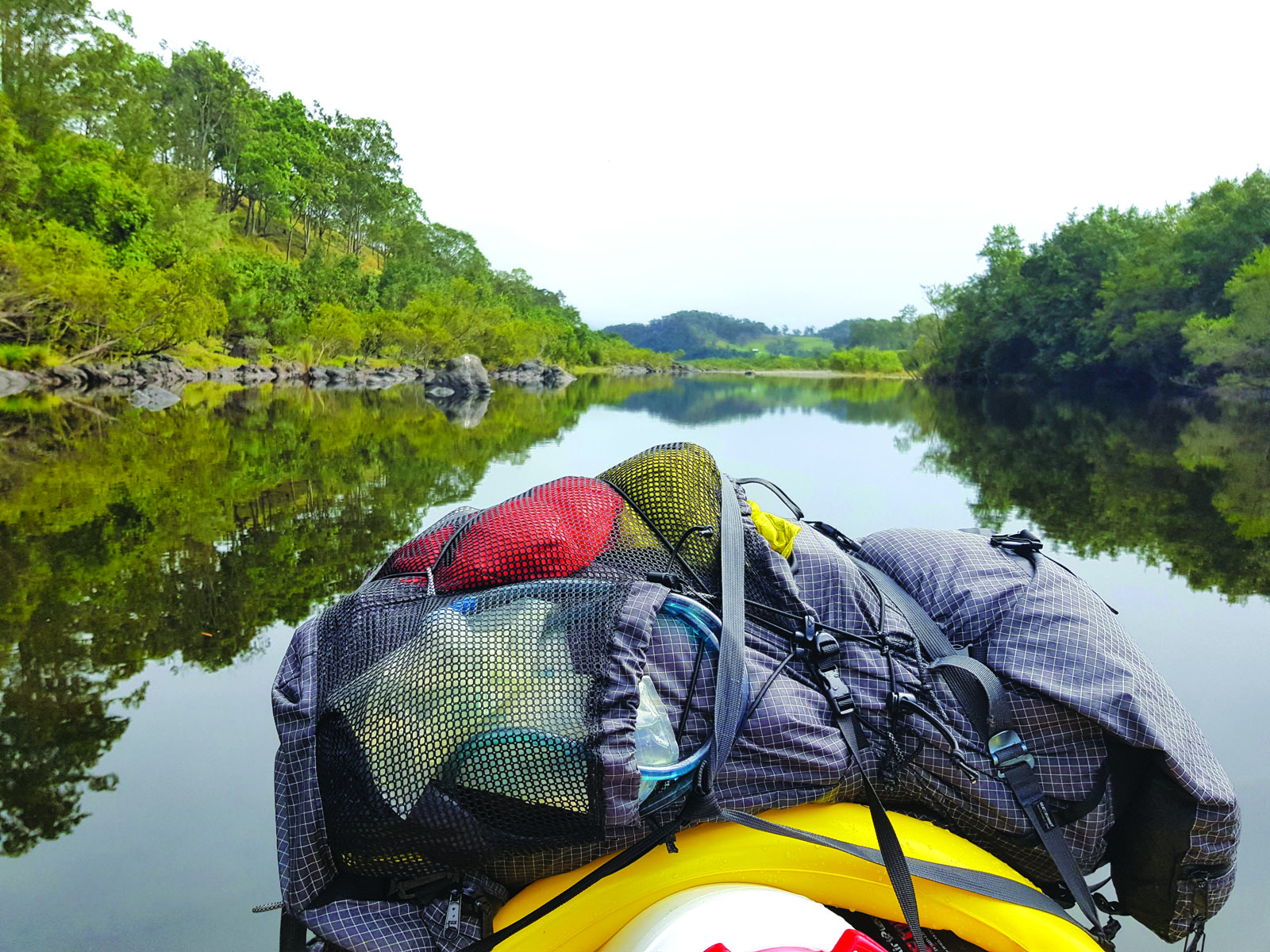
We pull over for lunch after one particularly scratchy rapid, at which point we twig that the dry bags wedged into the bow and stern have for a while been fully submerged, a state which they are not designed to handle. Our food, tent and spare clothing are all sopping wet. Could things get any worse?
Well, instead of a soggy sandwich I am handed our kayak’s battered skeg, which has finally been smashed free of its slot by its thousandth collision with the immovable riverbed. Paul has managed to scoop it up as it made its break for freedom and I examine its splintered flange; it is beyond repair. I had obtained this essential steering tool from the US at great expense after our original had somehow disappeared on a previous trip, apparently pulled off overnight by a falling and rising tide. The last day of that journey, unable to steer, drifting in endless circles but not knowing why and thus blaming each other, nearly ended in divorce.
This is the final nail in our inflatable coffin, the death-knell of our once-a-year Easter adventure, four days of time off wasted. A sense-of-humour breakdown ensues. Luckily we are still close enough to Jackadgery, such that Paul can hitchhike to his car and drive us back to Copmanhurst, where the keys to the second vehicle elude us for over an hour while the holiday rain sets in with a vengeance. Soaked through and cold, we set up our meagre tarp, mop out our tent and huddle around the gas stove. Eventually, with a hot meal and some grog inside us, we relax a little. “You can’t win ‘em all,” we collectively shrug, and when our losing streak finally concludes with Gerda’s sleeping mat popping a baffle, we even manage a chuckle.
For all the rain that falls over the next three days (and we have successfully found the wettest part of the country), it makes not a jot of difference to the overall river levels. After Australia’s hottest summer on record, some NSW weather gauges recorded their wettest Easter ever, and others their driest. Cangai received 44mm over the week (5-10mm, my arse!) compared with just 9.2mm for the rest of the month combined! Has our Easter been ruined by climate change? Not exactly, but our future will undoubtedly be affected by extreme weather events, despite what the coal mongerers claim. Between floods and drought, white-water kayaking may one day become a rare activity in this beautiful country, which would be a damn shame.
THE CLARENCE CANOE AND KAYAK TRAIL
The Clarence River Canoe and Kayak Trail spans 195km. It includes eight waterfalls, 12 campsites and eight sections. Stretching between Nymboi-Binderay National Park and Copmanhurst, the trail includes the Nymbodia, Mann and Clarence rivers. Paddlers encounter calm and level waters, as well as rough and challenging rapids up to Grade 4.
Maps and information regarding the route, necessary portages, minimum water levels and more, can be found online at www.myclarencevalley.com