
The Princes Highway is widely acknowledged as the scenic alternative to the Hume. Drivers along its bituminous length, barrelling from either Melbourne or Sydney, gaze outward and are struck by the beauty of the landscape.
This is, of course, just what you can see from your car. Adventure-seekers in the know apply their brakes and come to a stop in one, or more, of the stunning destinations – many of which reside in Central Gippsland, around three hours from Melbourne CBD (and even less from the eastern burbs).
Central Gippsland distils the essense of Gippsland: diversity of terrain. The landscapes here form their own condensed world, with different environments closer than the flip of a page in a geography textbook. Environments which, in our vast country – by no means Lithuanian in dimensions – you often find many petrol tanks apart. This diversity of land results in diversity of appeal, to all sorts of adventurous appetites. Here’s a quick glimpse...


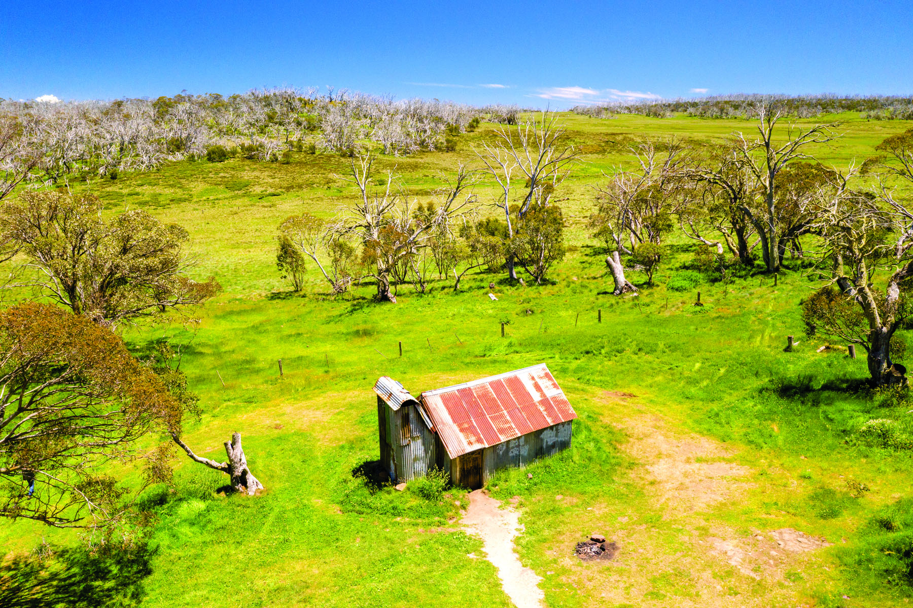
Credit for hut image: mikulas1/Getty Images.
UP IN THE ALPS
Adventure can head uphill, if exertion is your fix; or downhill, if you’re after adrenaline. In any case, the presence of undulating terrain is a great indicator that adventure is close at hand.
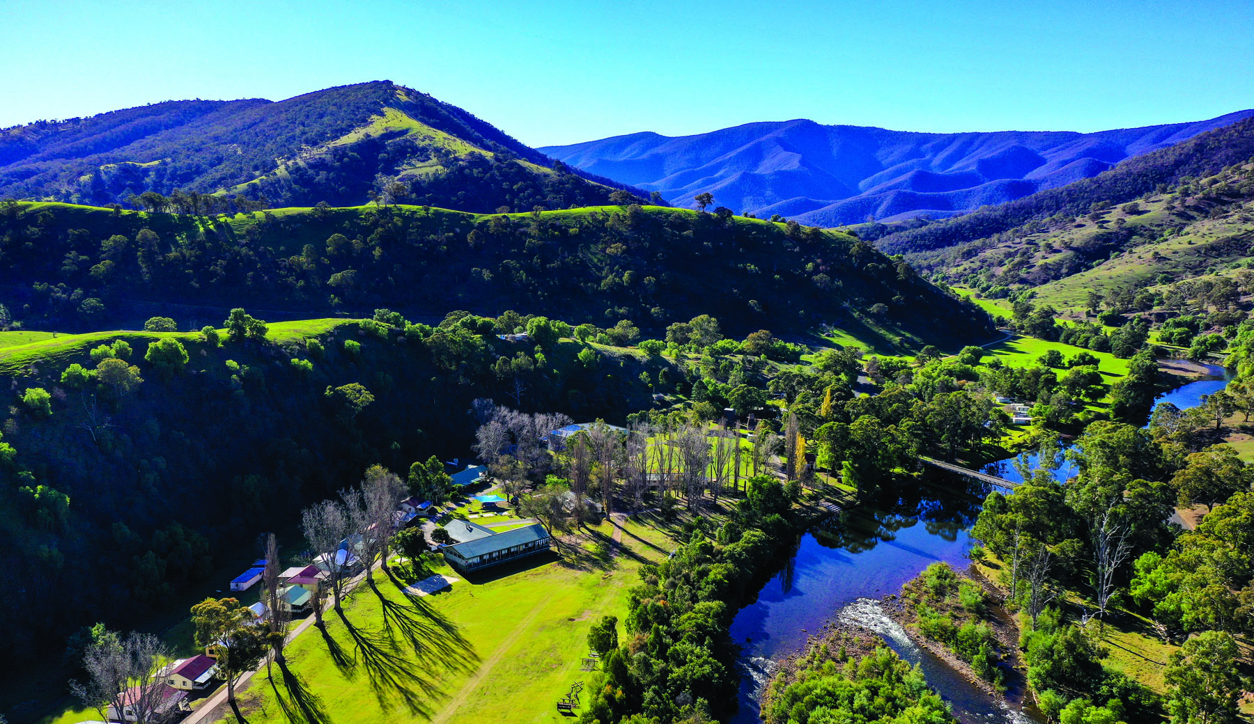
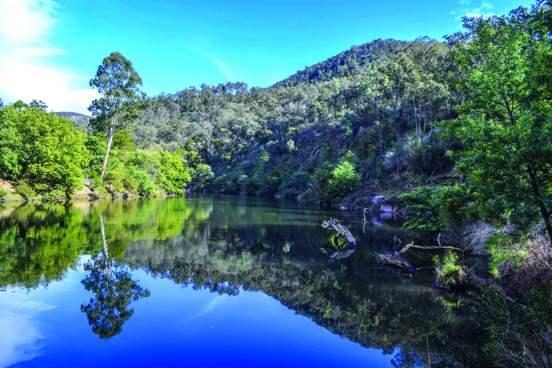
In the upper stretches of Central Gippsland, we find terrain of this description. On its east, we have Licola, and on its west, Dargo – two towns that are perfect bases from which to experience this highland brilliance.
Dargo is down-to-earth, with a population of around 150, made charming by its gold mining history. Forest coats the slopes nearby, a river flows beside town and all around rise mountains with stony faces. You can dine at the Dargo Hotel or River Inn.
Licola, with its population of 20 to 30, is a privately-owned, self-sufficient town – but it’s no less welcoming for it. As the temperature rises, the snow on higher ground melts, funnelling down into the nearby Macalister and Caledonia rivers and making for spine-tingling paddling expeditions.
In Howitt Plains, best accessed from Licola, stands Mt Howitt at 1742m. The peak can be attained by various tracks, which all merge up top for a stunning view, wide-reaching because there is nothing to obscure sight-lines. The walk up offers galleries of snow gums, a unique A-frame hut, and leaf-locked glimpses of faraway ranges. This peak is part of the Australian Alps Walking Track, a mega-track covering 650km from Walhalla to Canberra.
For Alexander Supertramp types, Avon Wilderness Park will satiate your appetite for solitude. This 39,650 hectare park, accessible only by foot, not by vehicle, presents the challenges – such as undefined tracks, narrow spurs and rough terrain – that so appeal to the self-sufficient outdoors-person. Here, too, avid rock climbers may find some tough slopes on which to satisfy their upward tendencies.
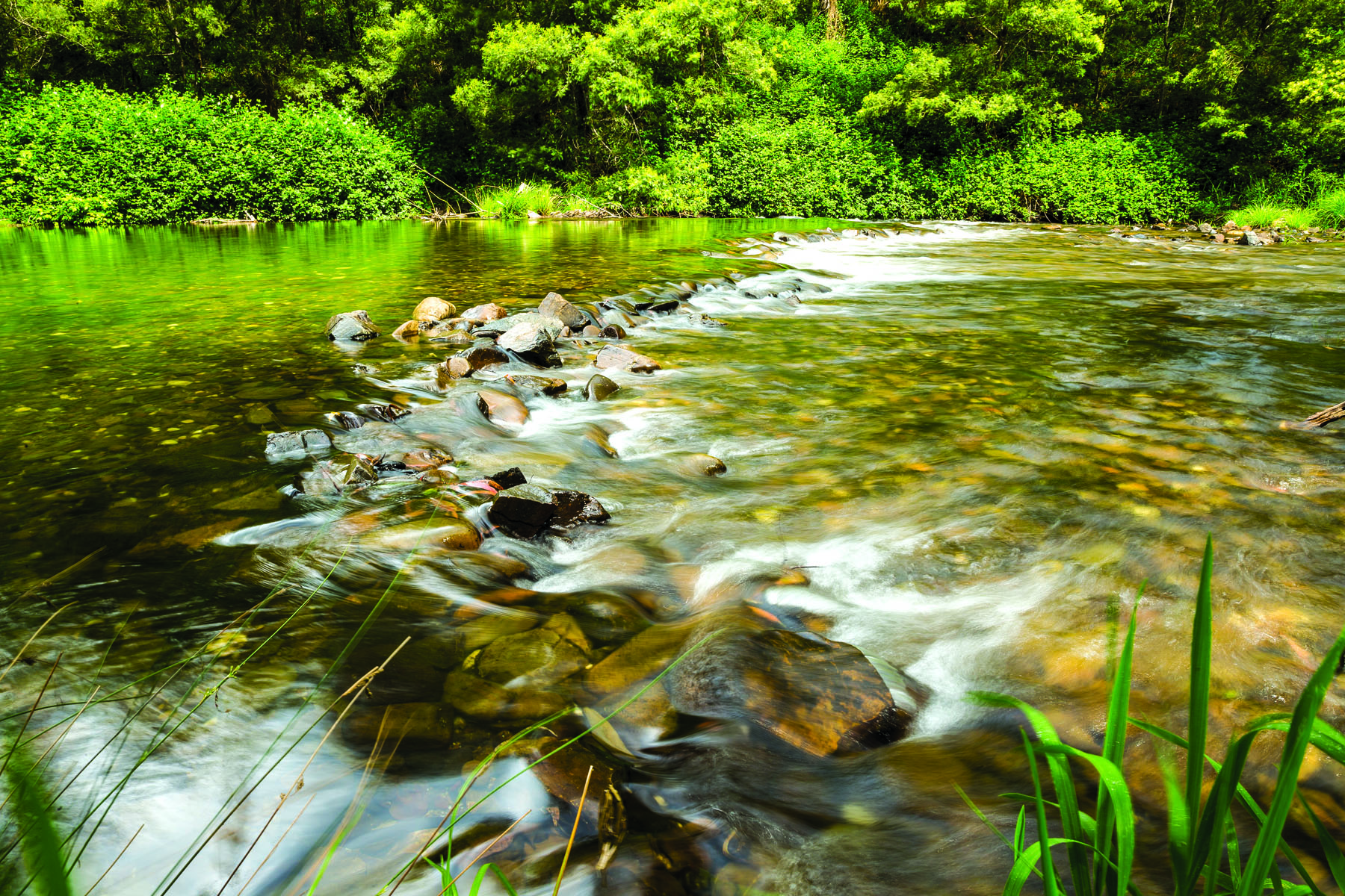
To the west, best accessed from Dargo, we find Mitchell River National Park. The park offers brilliant overnight hiking opportunities, with various campsites. The main hiking track takes you riverside; sometimes by the bank, other times well above it, on the sides of the gorge, with almost vertical views down. The visual crescendo comes at Billy Goat Bend, where, after splitting around an island, the river veers violently to the left, buffeted by exposed orange cliff faces on one side.
The Den of Nargun is also in this National Park. It’s a wide, shallow cave, often with streams of water flowing over its entry. The lead-up to it is through lush, mossy forest in the bottom of a valley. The sudden drop in temperature here contributes to the eerie, mystical experience on offer.
Other stand-out features that Licola and Dargo put at your disposal include: Bryce Gorge (with its ravine and Pieman and Conglomerate falls); Lake Tarli Karng (a lake at altitude, sacred to the indigenous, accessible via walks); and Grant Historic Area (where remnants of long-gone townships mingle with rivers and dense forest). Both are also great launching pads into the humongous Alpine National Park.
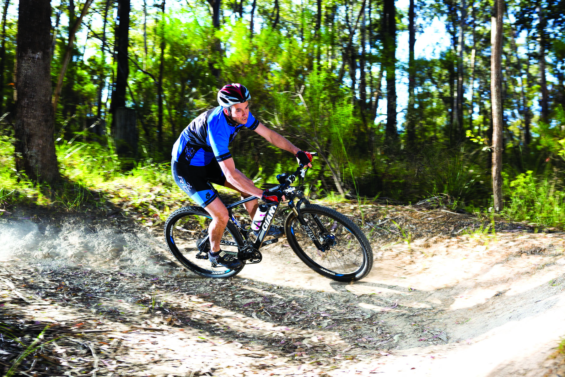
Have the bikes ready; driving to either of these towns takes you past Blores Hill Mountain Bike Park, in Heyfield. This park consists of about 50 acres of natural bushland, threaded through with MTB trails. Whatever your competence, there awaits some singletrack with your name on it.
As many are no doubt aware, some of Central Gippsland has been subject to bushfires over the years. Such fires are, in part, a result of the density and purity of the flora in these regions. When a fire does happen, it oftentimes doesn’t devastate the landscape; such is the resilience of the Australian bush. Certain trees, such as gums, have bark that is resistant to fires; plus they release seeds during fire and then thrive in the ash-rich soil. For visitors, then, all that's left is to exercise a bit of foresight in the summer months and to appreciate the geographical wonders of restoration.
THE HEARTLAND
Now for a quick tour of the other gems within Central Gippsland. There’s nothing more liberating than endless beach. Turn your head right or left and you’re faced with uninterrupted sand; in front of you rumbles the ocean, which stretches to the horizon. This is 90 Mile Beach, one of the longest continuous stretches of beach in the world, expanding from Port Albert to Lakes Entrance.
In the same vein of grandiosity, we find, north of the beach, one of the largest inland lake systems in the world – the Gippsland Lakes. This system expands some 400 to 600 square kilometres. It’s the perfect place to get out on the waters, perhaps in a kayak.
Above this again, we enter Gippsland’s heartland – perfect for those who spend their time on two wheels. Here various cycling trails follow old, historical railways. Pedalling along one of these is like unwinding a long historical thread from the fabric of time.
Among these is the Gippsland Plains Rail Trail. This travels along a now-defunct railway, first opening in 1883, that traverses 63km from Tralalgon to Stratford, linking various towns such as Maffra and Heyfield. This rail trail can be zooted along gung-ho, or completed at a slow pace – allowing riders to visit to wineries, restaurants and art galleries.
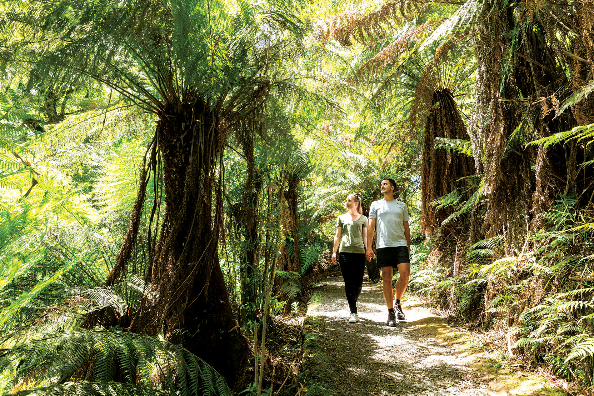
For those who love a navigational hiking challenge, Tarra Bulga National Park could be your honey hole. Tarra Bulga is a firework of nature; plant species abound, high and low, fragrant and majestic – as do flurries of flapping and furry colour.
You can take various walks from the Tarra Bulga visitor centre – for example, the 4.4km Forest Track. If you are after something longer you can link shorter tracks to make long loops, or else tackle the Grand Strzelecki Track through dense forest, historically inaccessible to the public; a 26.4km stretch of it links Morwell and Tarra Bulga National Parks.