
FROM CHRISTCHURCH TO QUEENSTOWN
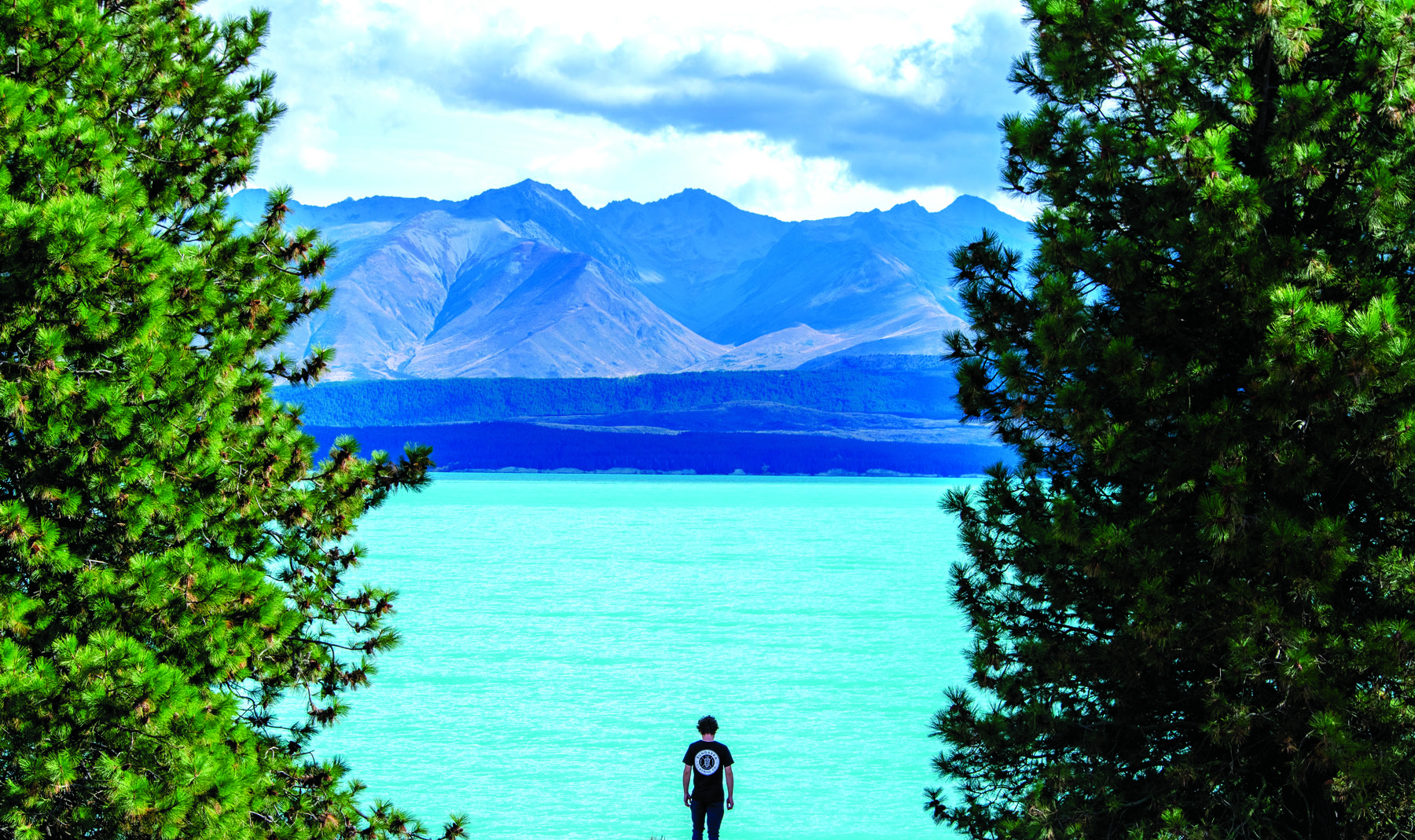
From the runway to the road to the walking tracks, as quick as humanly possible. That’s how we pictured our trajectory as we landed in Christchurch, on a clear sunny day in late April. But after driving 220km, we found ourselves held up at Lake Tekapo, as if by gunpoint, by the colour of that water. After shaking off the shock we drove towards Mount Cook Village, and here our boots found solid ground, for a while.
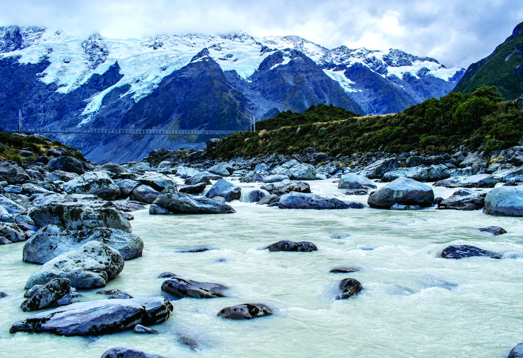
We waltzed along the Hooker Valley Track to the first swing bridge gulfing the Hooker River, which surged, white and cloudy, with melted snow. But alas, a rockslide higher up the track meant the bridge was closed as a safety measure. Swimming across did not appeal.


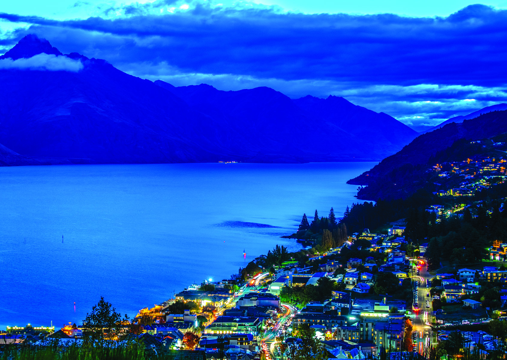
So we drove back and turned to Wanaka, by this point our appetites for hiking whet to a sharp edge, like that of a bowie knife. Wanaka astounded with its detour up to Blue Pools, its autumn-tree lakefront, and fjord-like magnificence; as did its brother in arms, Queenstown. On our first afternoon here we headed along the Time Walk, through the cool and profound darkness of the forest and up to the vistas above. Descending, the town’s glowing lights welcomed us back into warmth and comfort, just as the night-time chill came on.
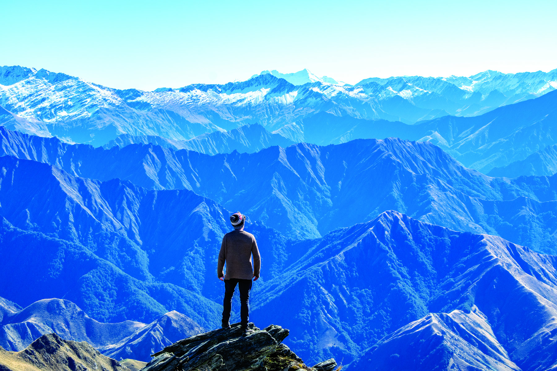
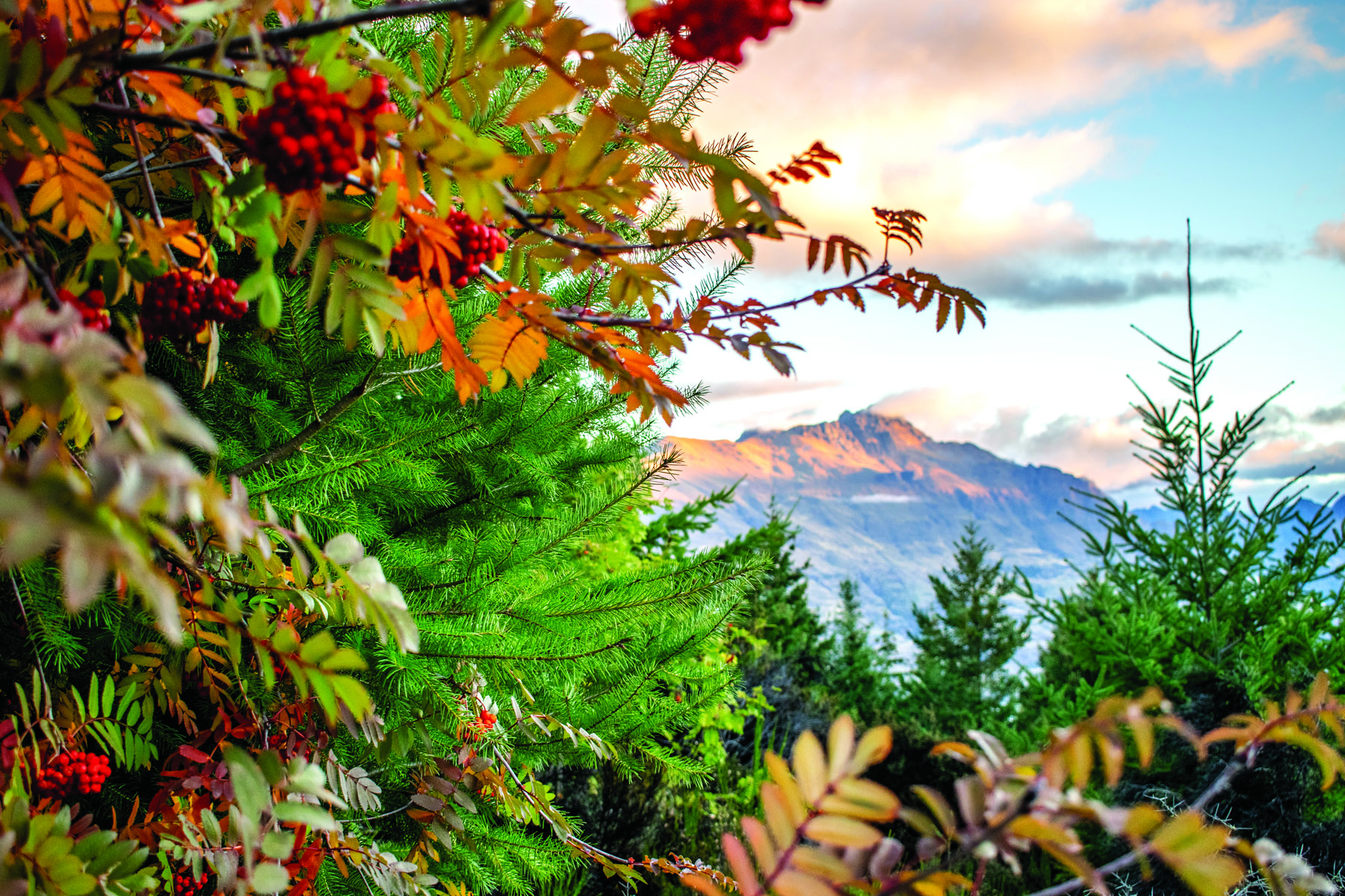
BEN LOMOND TRACK
Ben Lomond is a recurring name in mountain folklore. The so-called in Queenstown’s backgarden measures 1,748m; in Outdoor’s opinion, this is the right kind of skyscraper. It towers over the town, which itself stands just over 300m above sea-level. Looking at the peak and its extended family from lake level, one may be inclined to gulp; but gulping never did stop us adventurous types.
Hikers can catch the gondola for a leg-up, but we set off on foot from the streets of Queenstown. We zig-zagged our way up the mountain, through dark forests full of high-adrenaline MTB tracks and mountain goats; then progressed onto mound-like open ground covered in alpine tussock, all the while steadily gaining elevation; before reaching the saddle, catching our breath, and tackling the final stretch.
At the end of this at-times brutal rockhop, we arrived suddenly at the peak, where we were blessed by 360 degree views all around. The views extended back to the town on one side, and towards layers of purple-hued mountains, rippling up to snowy peaks, on the other. Perhaps the heartiest recommendation I can give for this place is that, the second we made it back to town, I started Googling house prices.
MILFORD SOUND, THE CATLINS AND HOKITIKA
Travelling through New Zealand is like finding yourself in the world’s best candy shop, being offered every lolly under the sun by the overly generous staff, and yet, somehow, however much you eat, never becoming sick – only perhaps a little pudgy with experience. Our next stop was the figurative sweet tooth’s Holy Grail, Milford Sound.
After a morning of winding through pastoral lands covered in thick fog, we entered Fiordland National Park. Every road seemed to travel towards a sudden, dramatic summit; when these extended beyond the height of the windscreen, we were obliged to stop and observe them on foot. But Milford boasts more than sheer size; it has stunning little details too, like hidden waterfalls or the swing that offers a view of Mitre Peak. If I had to pick my favourite spot I’d say the alpine plateau atop Key Summit. Reached by foot, it’s one of the few opportunities – apart from the airborne tours – whereby you can truly go above the enclosure of mountainsides to appreciate how far this terrain extends around you.
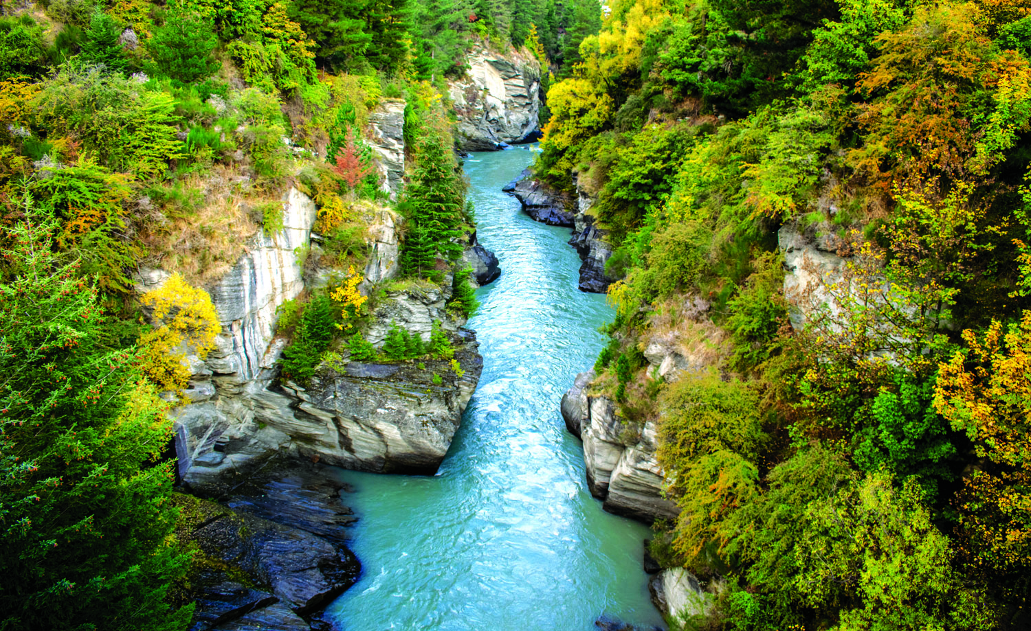
Our next leg encompassed a southern swoop to Invercargill, a traipse along the coast through the Catlins, and a romp towards Christchurch, before we swerved west at the last moment, to head through Castle Hill (a boulderer’s dream), Arthur’s Pass (home of the cheeky Kea) and Hokitika (with its glowworms, fairy lights, blue gorge and black beach covered in gnarled driftwood).
NELSON LAKES, PICTON AND KAIKOURA
Our minds hadn’t had the chance to process the last thing before it was onto the next... Our sense of bafflement mounted; let it mount, I say. No use trying to make sense of a place like this!
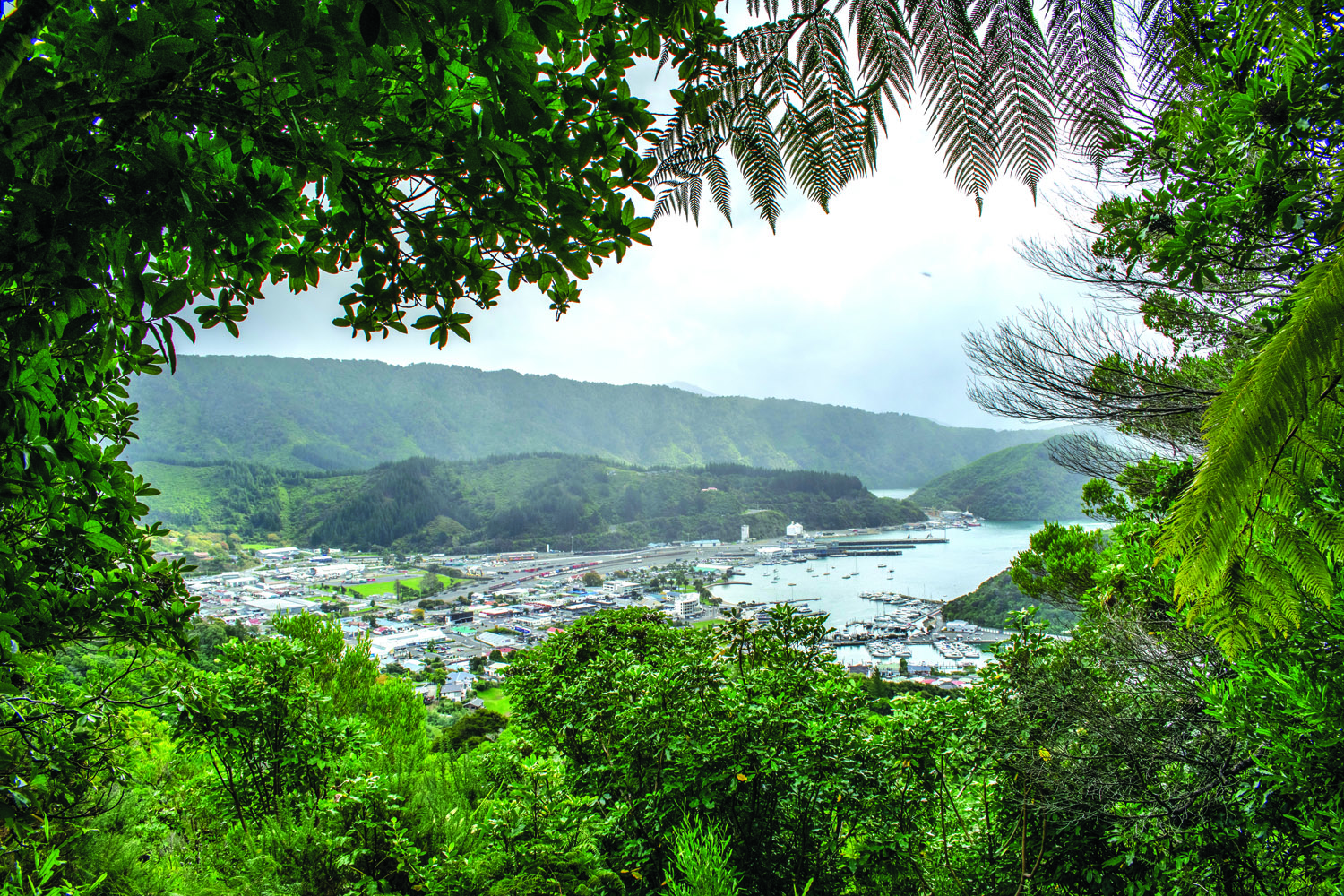
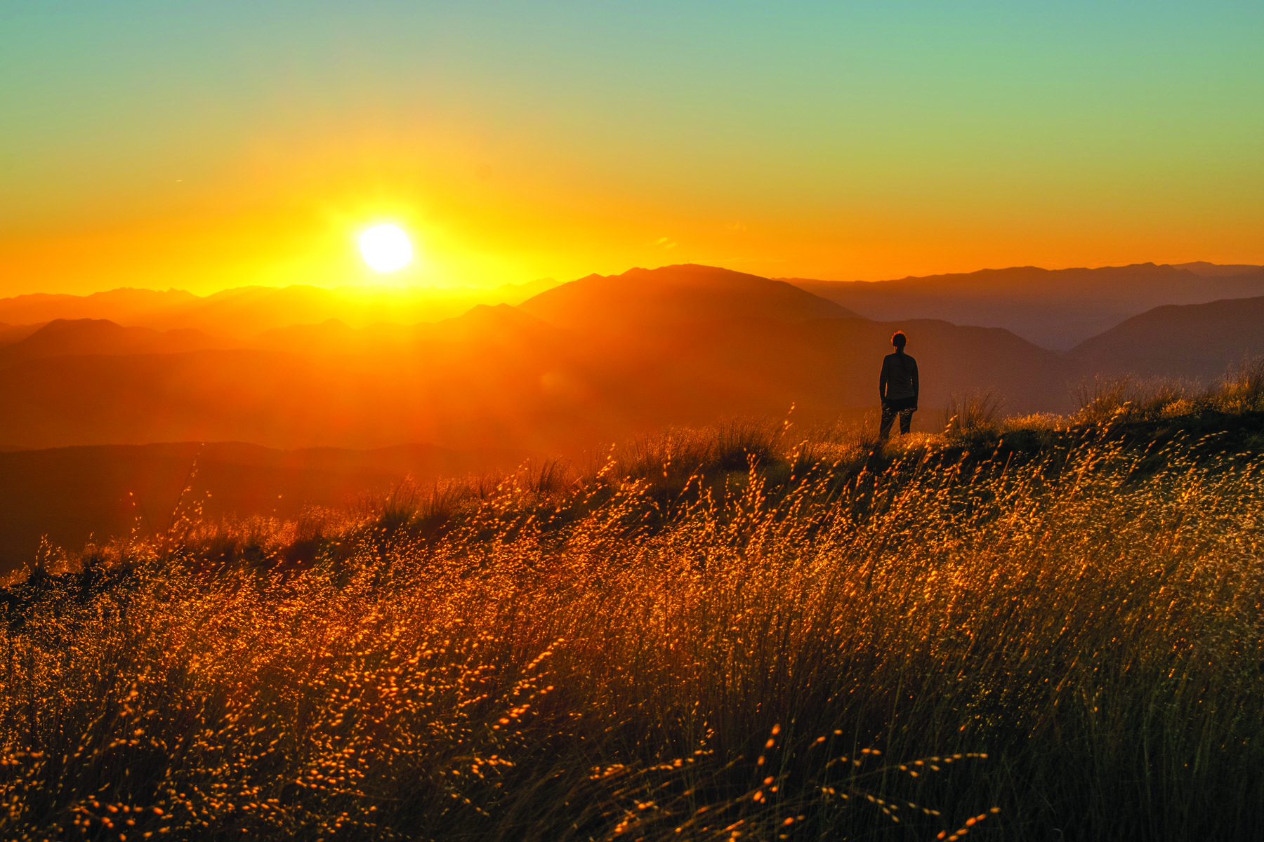
We cut north-east to Nelson Lakes National Park, arriving at Lake Rotoiti in the afternoon to be greeted by freshwater eels; running in terror from these fascinating beasts, we found ourselves half way up Mt Robert and, based on the cracking view back to the lake, decided we might as well continue. Soon, we came upon a hut and here enjoyed a pearling sunset in solitude. After walking down in the dark, we continued on to Picton.
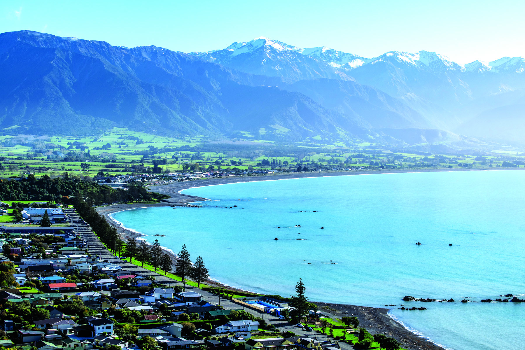
Overnight, the rains – so far missing in action – unbuckled the belt, kicked up the feet and settled in for a solid downpour. Unperturbed, we set out on foot, first above the town, and then along the Snout Track; the scent of petrichor and relaxing pitter-patter of rain on leaves supplemented the views. Soaked to the bone, we dried off in the car’s heater as we made our way to our last stop, Kaikoura. Black-pebbly beaches curling around to form a dolphin-filled bay, overshadowed by a snowy peak? Not a bad send-off...
As much as I would like to experience the whole world, I think I might forestall that with a few return visits to this stunning South Island.