
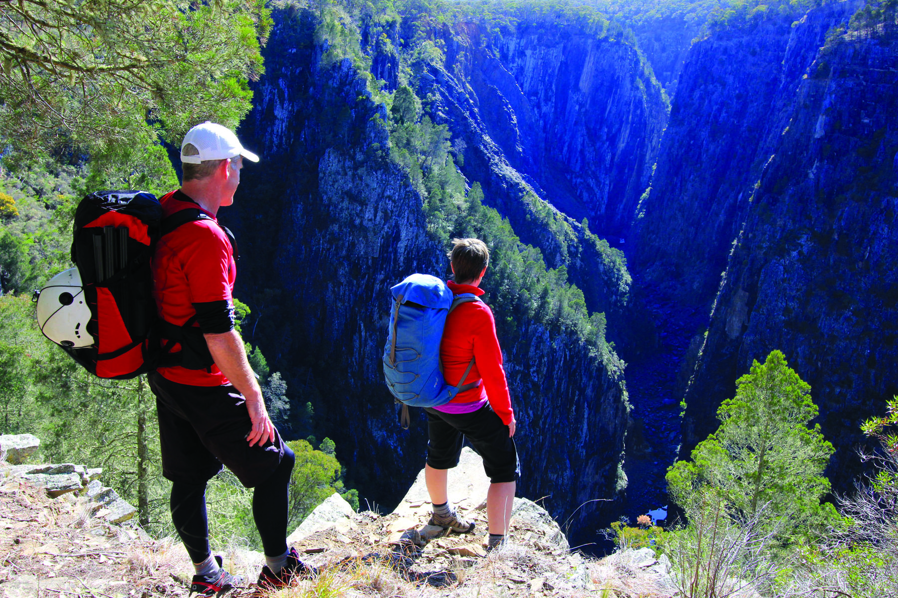
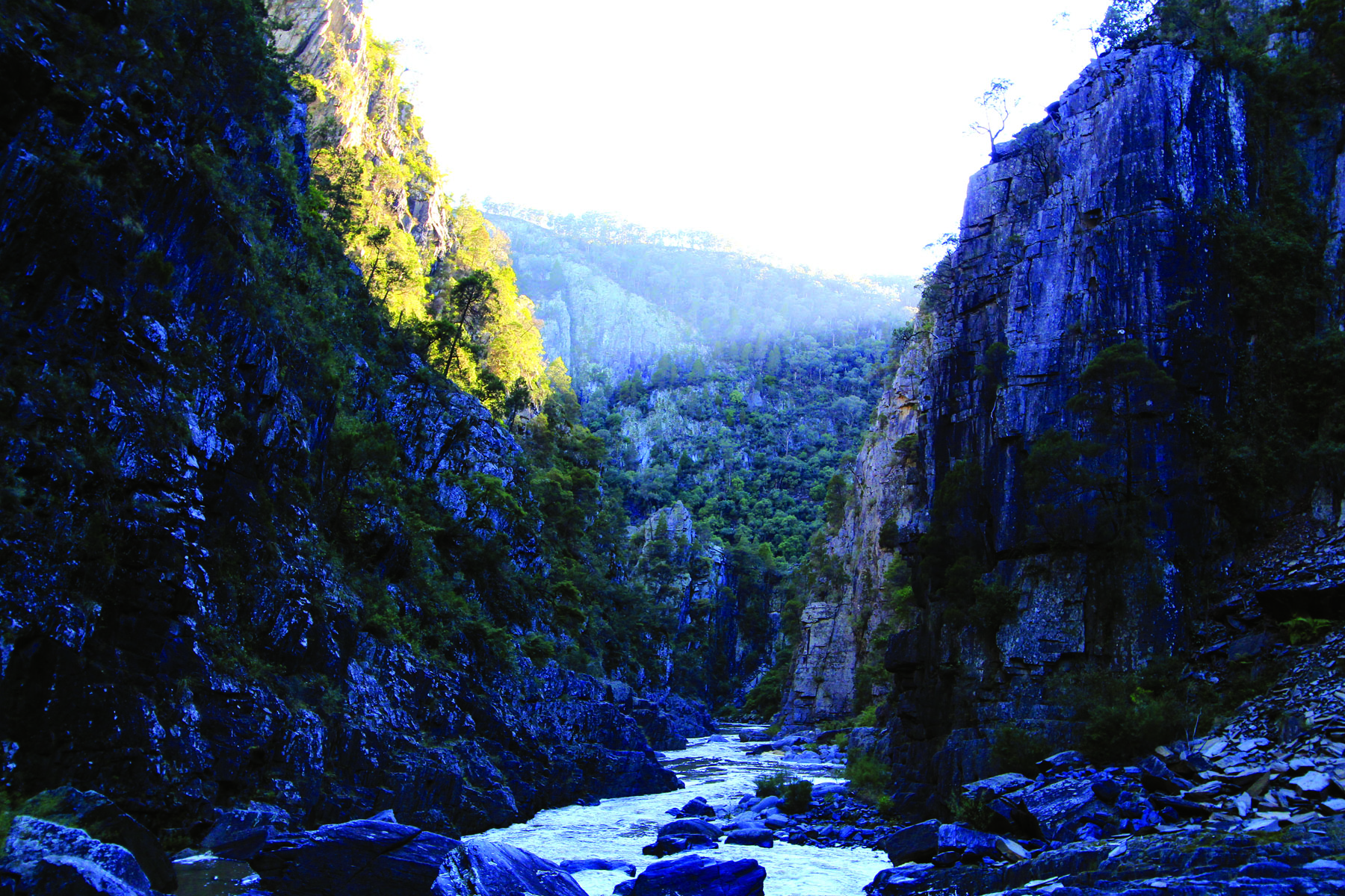
Clambering down the exposed slope that leads into Apsley Gorge, I pause to take in the amazing view. Morning sunlight illuminates towering rock walls, highlighting fresh scars where slabs of cliff have sheared and fallen from the gorge’s rim. In the shadows below, the gorge floor is littered with enormous boulders. It is intimidating and magnificent scenery – some of the wildest I’ve encountered.
While I’m stopped, I think to check my watch. It’s 8am. At that moment, the time has little significance other than confirming we have made a good, early start.
But, at 8am in the small town of Walcha, 20km upstream, a crowd is gathering on the Apsley River bridge. They have cameras ready and are waiting. We are about to learn there is something else coming to join us in the depths of this rugged valley.


EARLY ATTEMPTS
Twice before I have tackled this route into Apsley Gorge and each time I’ve said “never again”! It’s challenging and ridiculously steep; it looks an entirely improbable access point, from any angle.
Yet here I am, third time ’round. I’m with my partner Craig and our plan is to take three days to travel five kilometres downstream, photographing the scenic lower gorge in leisurely detail. Because, on each previous attempt we have returned without any photos beyond the same strangely cursed point, just 1.5km downstream, where two five metre waterfalls form a bend in the river.
On our first trip, in 2013, it took two hours to travel from our car to the two small waterfalls – negotiating huge boulders, dodging rock falls and paddling three deep pools in quick succession. Then, suddenly, the mirror in Craig’s SLR camera mysteriously dislodged, rattling around inside like an expensive toy.
What few photos we have show me unsmiling, looking nervously at the cliffs above. I was unsettled by the wildness of the place and, as much as the camera failing, it was this that made us call the trip off there and then.
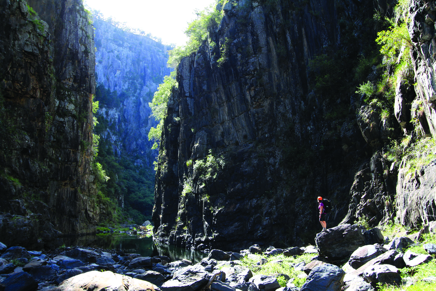
Fast-forward to 2015 when we successfully completed the full, 5km route as an exhausting but exhilarating day trip. It was rewarding stuff: below those two waterfalls the gorge walls are less than 10m apart with sheer cliffs towering 100m high on each side. But, in a rare lapse of concentration, Craig dropped his camera in the water. That was it. Again, no photos downstream of the same spot.
So, here we are – tackling a final rocky gully, then celebrating, once more, our safe arrival on the gorge floor. I shout to Craig “third time lucky” as we turn to face one of the most spectacular adventures I have had the privilege of undertaking and surviving. Despite the “never agains”, I am thrilled to be back.
IN THE FOOTSTEPS OF PIONEERS
In 1967, members of the Sydney Bushwalkers Club first successfully scouted and completed this trip through Apsley Gorge. The group’s original plan was to travel 40 miles ( 64km) downstream of Apsley Falls over four days. On day one, they managed two miles. Day two, four miles.
That experience is testament to the ruggedness of the gorge and the many challenges it presents. Trip leader Don Finch recounts a litany of woes: wet sleeping bags, meagre campsites, the stench of dead eels, hypothermia, and injuries. While a second report in the club newsletter, written by the indefatigable Dot ‘The Barefoot Bushwalker’ Butler gave this prescient summary:
“The first seven miles of the gorge involves as much swimming as walking. For this reason, it would be wise for anyone else planning this trip to find out about local rainfall during the previous week as it would be extremely hazardous, if not impossible, to swim the canyons in flood. Huge logs and other flood debris was piled 20 and 30 feet up the sides of the gorge.”
The Sydney Bushwalkers completed their trip a week after a flood event. However, despite Craig and I having done just as Dot suggested – checking the previous week’s weather and the local forecast – we are soon to discover we are only an hour ahead of another flood.
IN A FLASH
As we reach the top of the two small waterfalls, I check my watch again. It’s just after 10:30am. By now, the Walcha locals have seen what is coming and a few drive out to Apsley Falls hoping to watch this flash flood event, as it arrives and tumbles spectacularly over the 50m waterfall that is the main attraction of this river.
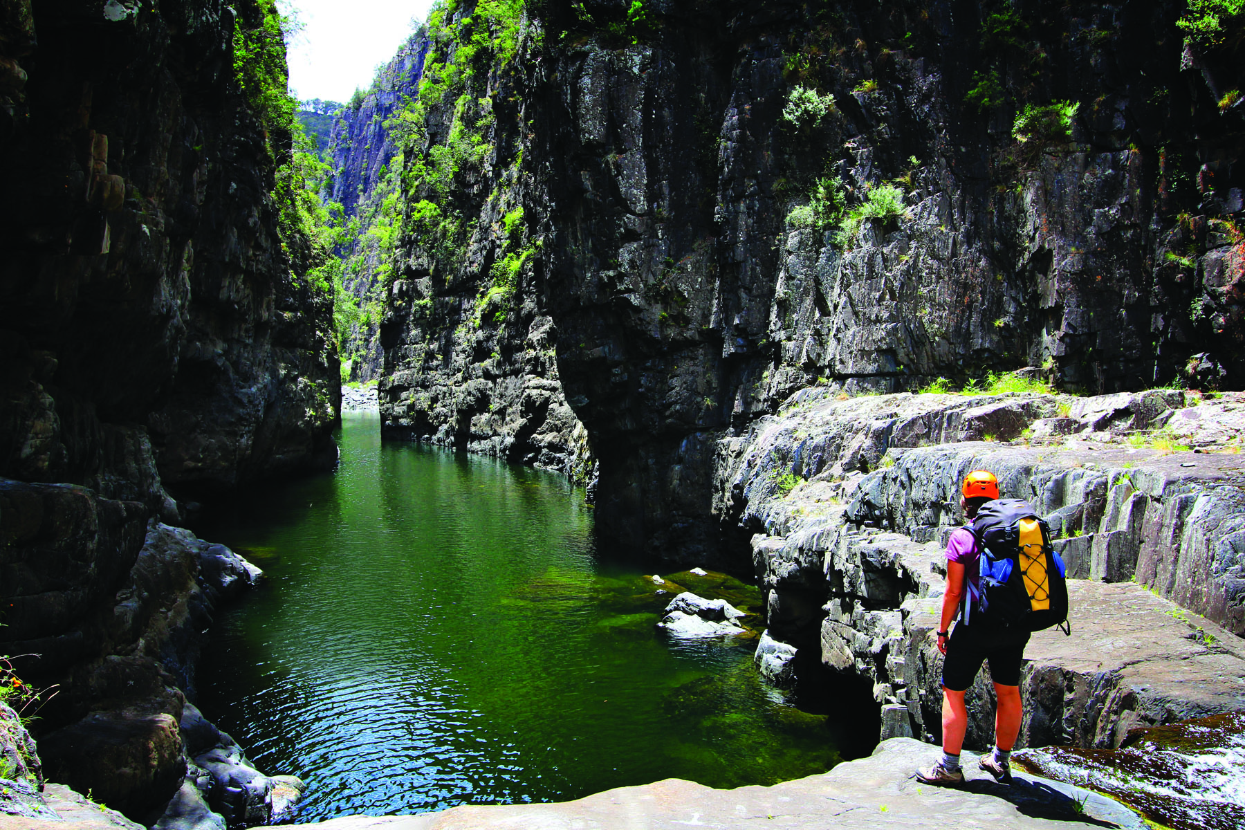
Down in the gorge we take our time, rigging up rope to help down-climb the first and then the second drop. I make a point of telling Craig to hold onto his camera as we begin paddling the narrow, spectacular pool below. This point in the gorge is the highlight of any trip. With the two waterfalls behind us, it is a chance to relax and admire the grandeur of such a rarely seen landscape.
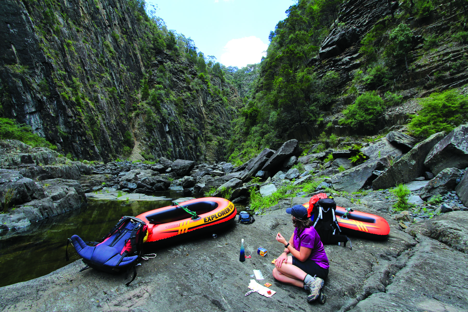
We play around taking photos before exiting the pool and continuing downstream, boats slung over our packs like tortoise shells. I check my watch again. It is 12:30pm. Lunchtime, I suggest to Craig. Sure, he says.
We throw the boats on a rock, drop our packs and spread our food out in the middle of the gorge. We joke about how much I hate the descent route and rename it ‘Never Again Spur’. Craig jumps up to get a couple of photos and so, again, I check my watch: 12:49pm. He takes two pictures of me sitting in the riverbed. In both, I am twisted around and staring upstream. It is because I can hear something – like a roaring, frontal wind. I search the landscape to see if the trees are moving but the day is still and sunny.
I keep scanning. Upstream there’s a gradient drop in the river. Through jumbled rocks I can see a trickle of the Apsley River. As I watch, the trickle turns into a tongue of whitewater. The roar is getting louder and it is deeply, deeply unsettling. The rocks I was watching are now covered. I jump up and yell: “Flood. Flood coming.”
I grab a boat and my backpack and race to higher ground – a tongue of scree slope we have so luckily found ourselves beside. There is no time to doubt what is happening. By the time I return for a second load, Craig has seen it too. He leaps across the rocks, grabbing his backpack and the other boat. The water has already arrived at our feet.
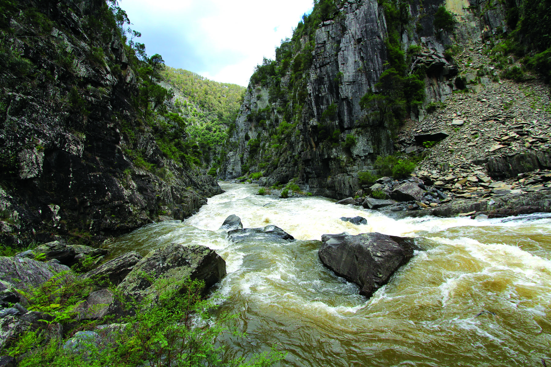
A first flush of clear green river builds. Then, churning, roaring, brown water is racing past, foaming and stinking with dirty run-off. As I watch, our lunch rock is already, astoundingly, two metres under water. The roar of whitewater echoes off the cliffs. A couple of logs rocket past. The river is unrecognisable. I check my watch. It’s 12:51pm. All of this in two minutes.
PERCHED ABOVE RAPIDS
For the first two hours after the flood arrives we simply sit and stare. The ‘what ifs’ haunt me. The change, our safety, our luck – all mesmerising.
In front of us are grade 4+ rapids. Looking around, there is no chance of walking out from this spot and our tiny vinyl boats are hardly built for this new river. We also know what lies under the churning water – sharp rocks, boulders and sieves. Our concern turns to the possibility of rockfall from the cliffs above. Then, what if it rains?
Prior to this trip, my weather research indicated there would be a chance of 6-10mm of rain tonight. We had reasoned there would be ample time to sit things out if rocks got slippery and hampered our progress. We were confident 10mm would not bring the river up enough to cause problems. Now, that is not so sure.
Upstream is a narrow flat shelf of rock beneath a slightly overhung wall. It offers barely any protection from falling rocks, but it’s all we’ve got. We set ourselves up to sit and wait.
Craig finally speaks: “Never, in my thirty years on rivers, did I think or imagine I would see something like this.”
A former whitewater rafting guide, Craig has worked on some of Australia’s best rivers – the Franklin, Gwydir, Nymboida. Together, we have undertaken many challenging whitewater rafting trips and yet, staring at that churning water and remembering how fast it filled this gorge, we can’t help but be impressed.
All afternoon, in a strange recurring phenomenon, the sound of the river builds to a roaring crescendo that reverberates in the narrow gorge. Each time this happens, we both look anxiously upstream. It sounds like another flood coming and the noise triggers a subtle, resonant fear underneath my thinking, wakeful mind.
By 5pm, the river is holding near its peak. There is no chance of going anywhere today, so we shift some rocks and make a rough sleeping platform. It is uncomfortably close to the river and offers imperfect, pathetic protection from rockfalls from above. Still, we put up the tent fly.
As we settle in for the night, steady rain begins to fall.
ESCAPING THE GORGE
On day two, the night’s rain ( 10mm in all) has slowed the river’s drop, but we wake to another sunny day. The water level is only half a metre less than its peak. Sitting and waiting for the valley to empty is not a solution.
As we got ourselves into this gorge, we put our minds to getting out of it.
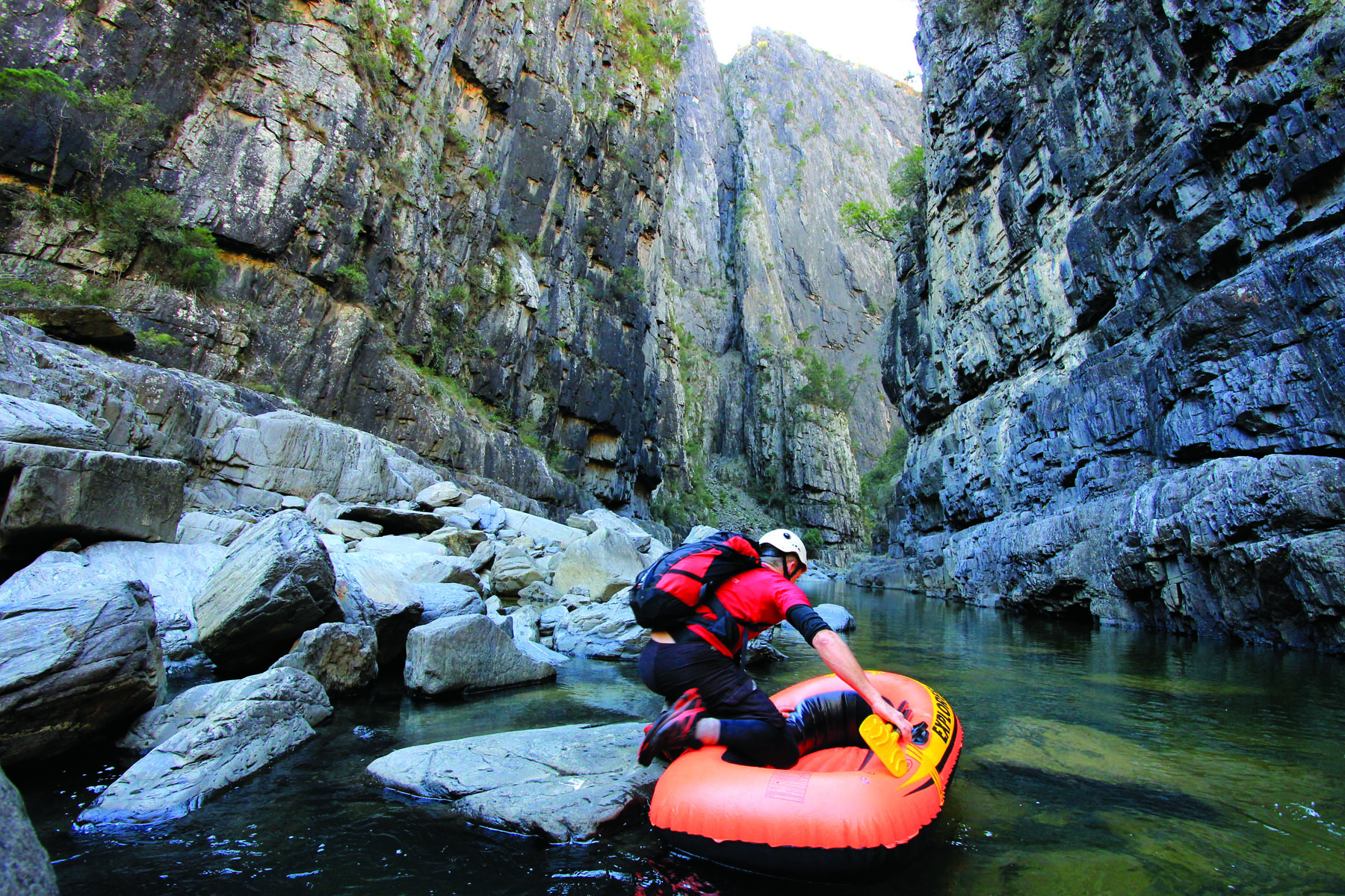
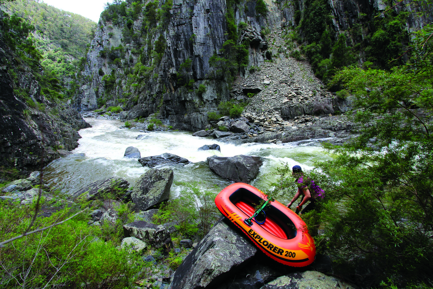
After packing up camp, we sneak upstream using what few rocks are not submerged, to the end of the long, deep pool. I jump in my boat and concentrate on executing a perfect ferry glide above the rapids.
Once over the other side, there is a bank of gravel and bedrock that we use to scramble past the rapid that was once our peaceful lunch rock.
Using the true right edge, we creep downstream aiming for the next bend, having spied a possible exit slope that looks covered in trees and at least free of cliffs. At this stage it is our only option.
To get there, we portage several rapids before finally paddling into the main current, to negotiate a couple of rocks then drift into an eddy in a big pool. If only we had decent whitewater rafts, the adventure would be just beginning.
But Craig reminds me how the river runs from here – huge boulder block-ups and narrow gorges, gradient drops and cliffs that might be choked with rapids and impassable on foot or by boat. This corner slope is our best bet. We stow the deflated vinyl boats in our backpacks and wish each other luck.
It is a hard, hard exit, more like a climb than a walk. I haul myself up the dusty, loose slope, grabbing trees and trusting my weight to shrubs anchored tenuously in the crumbling shale. It takes two hours of exhausting, nerve-wracking ascent to get to the open farmland above, where I let out an involuntary string of swear words then collapse on the ground, emotionally and physically spent.
We still have no photos of the scenic lower reaches downstream of those strange, cursed waterfalls. I look across at Craig. Never say “never again”. I will have to do Apsley Gorge all over, won’t I?
THE FLOOD IN NUMBERS
We had camped at Apsley Falls campground the night before this adventure, under starry skies with some lightning visible far, far to the west.
Afterwards, we learnt that an isolated storm event had dropped more than 135mm of rain high in the river's headwaters.
The automated river gauge above Apsley Falls shows that until 11:30am the water level was 0.28m. Within 40 minutes, it reached its peak of 1.49m. Within the confines of the gorge, the river rose even faster and higher than these recordings show.